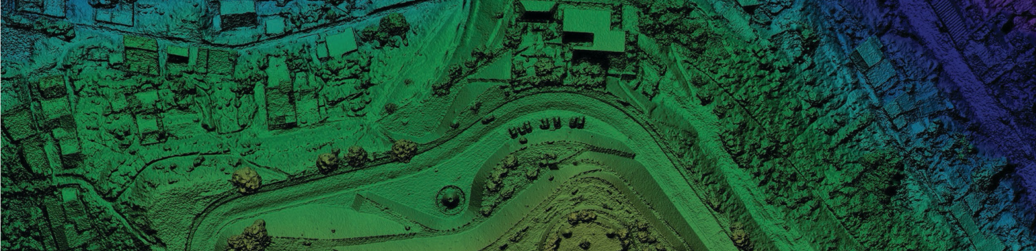
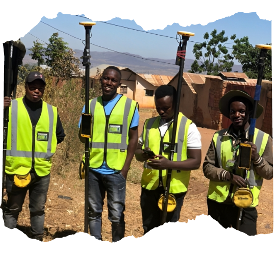
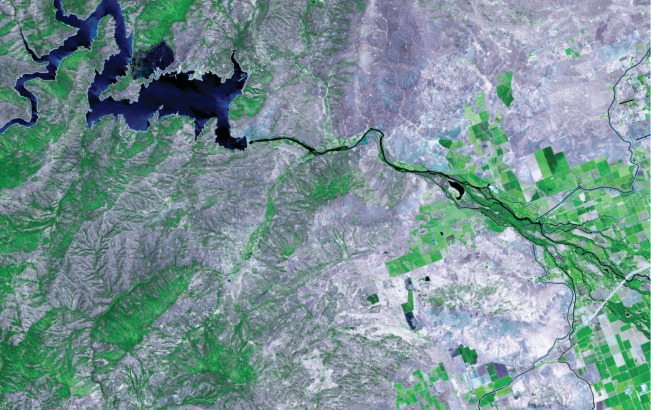
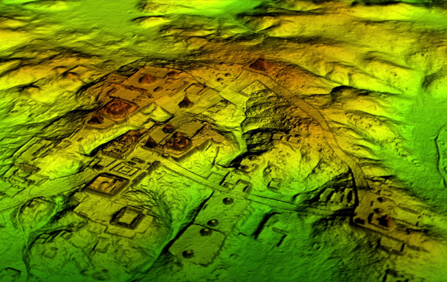
Unlocking Africa's Potential through Precise Geospatial Solutions

With advanced technology and expertise, AGS offers tailored solutions. From topographical surveys to drone mapping, we deliver accurate results. Unlock the power of geospatial information - partner with AGS.

lidar

About Us

Transforming Africa's Geospatial Landscape with Precision and Vision

Why AGS is the Preferred Choice

Africa Geospatial Solutions – named as AGS is a privately owned survey and mapping company with headquarters in Dar es Salaam branches in Arusha and Kilimanjaro. Africa Geospatial Solutions provides the entire solutions in the fields of survey, mapping as well as project management. AGS takes pride in offering end-to-end solutions. We employ state-of-the-art technology and advanced geospatial tools to ensure accurate data collection, analysis, and visualization.

  • Completed projects

  • Advanced tools

  • Clients served

About Us

Our Services

Empowering Projects through Comprehensive Geospatial Services
Geo location and mapping image

Geo location and mapping

Geo-location relies on coordinates to pinpoint specific locations on the Earth's surface. These coordinates are determined using Global Navigation Satellite Systems (GNSS) such as GPS (Global Positioning System).We provide and maintain Spatial databases in supporting prototyping and high-volume production of urban, regional, natural resource, business and utility networks databases. Apart from development of GIS databases, AGS also offers other Geospatial and mapping services.

Topographical Surveyingimage

Topographical Surveying

Topographical surveying in Tanzania relies heavily on accurate surveying and mapping techniques. Providing accurate measurements and mapping of sites for engineering and construction purposes. Assisting in the design and layout of infrastructure projects such as roads, bridges, pipelines, and buildings. Establishing reference points and markers on construction sites to guide the placement of structures and utilities. We work with Architects, Consulting Engineers, Local Authorities and government to deliver major infrastructure & construction projects.

Cadastral Surveyingimage

Cadastral Surveying

Cadastral surveying in Tanzania typically refers to the process of obtaining legal rights to land or conducting land-related transactions in the country. Tanzania has specific laws and regulations governing land tenure and land administration. Our surveying and mapping department comprises of technical and professionals registered surveyors under ‘’THE LAND SURVEY ACT Chap 277’’ and are members of Tanzania National Council of Professional Surveyors.

High Resolution Satellite & Drone/UAV image

High Resolution Satellite & Drone/UAV

AGS offers high-resolution satellite and drone/UAV imaging services for various industries. Their advanced technologies provide detailed visual data, revolutionizing decision-making processes. With satellite images, they enable precise land cover mapping, environmental monitoring, and infrastructure planning. Their drone/UAV imaging services offer site surveys, precision agriculture solutions, and real estate assessments. By leveraging these services, businesses can make informed decisions, optimize processes, and gain valuable insights for success.

Remote Sensing including LiDAR Services image

Remote Sensing including LiDAR Services

Remote sensing such as LiDAR services revolutionize Earth surface observation and analysis. They capture data using satellites, aircraft, drones, or ground-based sensors without physical contact. These services provide wide-area coverage, higher-resolution imagery, and precise 3D mapping for applications in precision agriculture, environmental monitoring, disaster management, and infrastructure planning. They optimize crop management, enable efficient disaster response, and enhance infrastructure design.

Some Other Popular Services We Provide

  • Spatial & Land use Planning Services

  • Mobile & Web Mapping Applications

  • Navigation and Geo-Location Analytics

  • Map Design and Production Services

  • Geospatial Intelligence Solutions

  • Real time GPS Asset Tracking Service

  • Hydrographic/bathymetric solution

  • 2D Modelling

  • 3D Modelling

  • Assets managements

Our Partners

Powering Geospatial Solutions Through Collaboration
partner company logo

Contact Us

Creative Crew Behind AGS
Edward Muyanja

Edward Muyanja

Managing Director
Tumaini Thobias

Tumaini Thobias

Operations Director
Nanyorri Ngalesoni

Nanyorri Ngalesoni

Finance & Administration Manager
Dr. Alex Lubida

Dr. Alex Lubida

GIS Director
Gilliard Maliaki

Gilliard Maliaki

Director Survey & Mapping
Nancy Mushi

Nancy Mushi

Assistant Finance & Admin Manager

Contact Us

Transforming Ideas into Geospatial Reality. Contact Us Today!

FAQs

Unparalleled Insights Through Advanced Imaging Technologies